
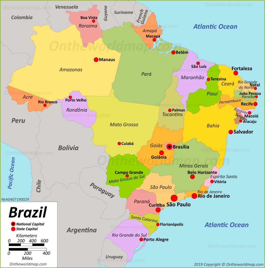
Brazil Political Map
Description:
This map shows governmental boundaries of countries, states and state capitals in Brazil.
States of Brazil:
You may download, print or use the above map for educational, personal and non-commercial purposes. Attribution is required. For any website, blog, scientific research or e-book, you must place a hyperlink (to this page) with an attribution next to the image used.
Written and fact-checked by Ontheworldmap.com team.
Brazil maps
Cities of Brazil