
Sri Lanka Map
Description:
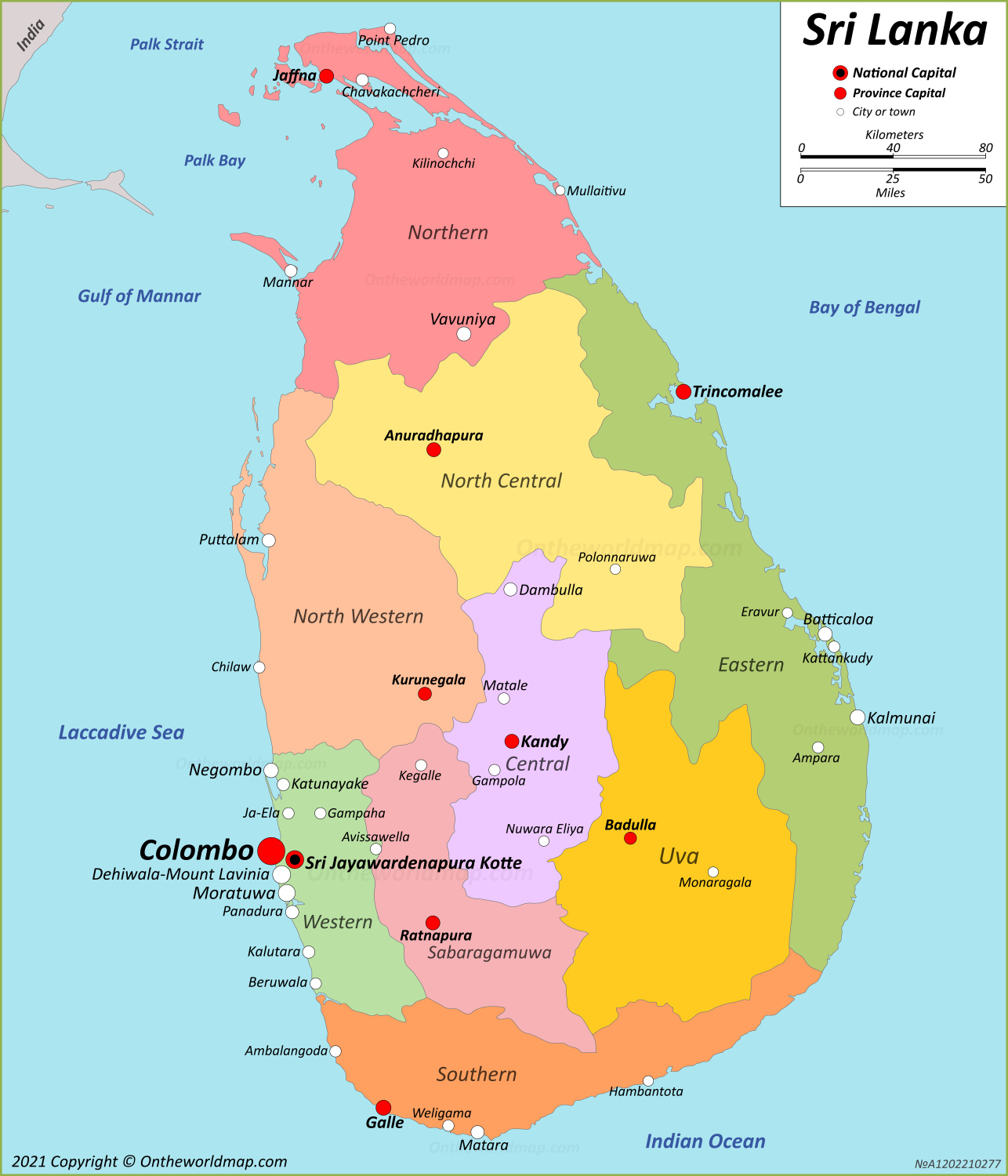
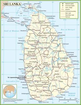
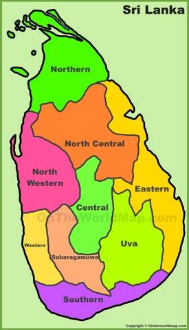
This map shows provinces, province boundaries, province capital cities, national capital, major cities and towns in Sri Lanka.
Size: 1286x1500px / 450 Kb
Author: Ontheworldmap.com
You may download, print or use the above map for educational, personal and non-commercial purposes. Attribution is required. For any website, blog, scientific research or e-book, you must place a hyperlink (to this page) with an attribution next to the image used.
Online Map of Sri Lanka
About Sri Lanka
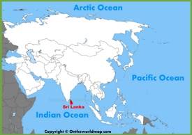
The country has a total area of 65,610 square kilometers and a population of approximately 22 million people. Its capital, Sri Jayawardenepura Kotte, is a suburb of Colombo, the largest city and commercial center. The official languages are Sinhala and Tamil, while English is commonly used in government and business.
The Facts:| Capital: | Sri Jayawardenepura Kotte (legislative), Colombo (executive and judicial). |
| Area: | 25,960 sq mi (67,240 sq km) |
| Population: | 21,756,000 (2025 estimate) |
| Official language: | Sinhala, Tamil. |
| Religion: |
|
| Ethnic groups: |
|
| Currency: | Sri Lankan rupee (Rs) (LKR) |
| Driving side: | Left |
| Calling code: | +94 |
| Internet TLD: | .lk |
| Time zone: | UTC+5:30 (SLST) |
| Gross domestic product (PPP) (2025 estimate): |
|
| Gross domestic product (nominal) (2025 estimate): |
|
| Largest cities: | Colombo, Kaduwela, Maharagama, Kesbewa, Dehiwala-Mount Lavinia, Moratuwa, Negombo, Sri Jayawardenepura Kotte, Kalmunai, Kandy, Galle, Batticaloa, Jaffna, Matara, Gampaha, Katunayake, Boralesgamuwa, Kolonnawa, Anuradhapura, Trincomalee. |
| Provinces of Sri Lanka: | Central, Eastern, North Central, Northern, North Western, Sabaragamuwa, Southern, Uva, Western. |
| Districts of Sri Lanka: | Ampara, Anuradhapura, Badulla, Batticaloa, Colombo, Galle, Gampaha, Hambantota, Jaffna, Kalutara, Kandy, Kegalle, Kilinochchi, Kurunegala, Mannar, Matale, Matara, Monaragala, Mullaitivu, Nuwara Eliya, Polonnaruwa, Puttalam, Ratnapura, Trincomalee, Vavuniya. |
Sri Lanka has a rich cultural heritage spanning over 3,000 years, with evidence of prehistoric human settlements dating back to at least 125,000 years. The country was known as Ceylon during British colonial rule until 1972. Buddhism plays a significant role in the nation's culture, with approximately 70% of the population practicing Buddhism.
The country's economy is primarily based on services, agriculture, and manufacturing. Sri Lanka is the world's fourth-largest producer of tea and is known for its production of cinnamon, coconuts, and precious stones. Tourism is also a major contributor to the economy, with visitors attracted to its diverse landscapes, including tropical beaches, rainforests, and ancient Buddhist ruins.
Sri Lanka's climate is tropical and warm, with monsoon seasons affecting different parts of the island at various times of the year. The country is home to a diverse array of flora and fauna, including many species that are endemic to the island. It has been identified as one of the world's 36 biodiversity hotspots.
Maps of Sri Lanka
Cities of Sri Lanka