
Colombo Map
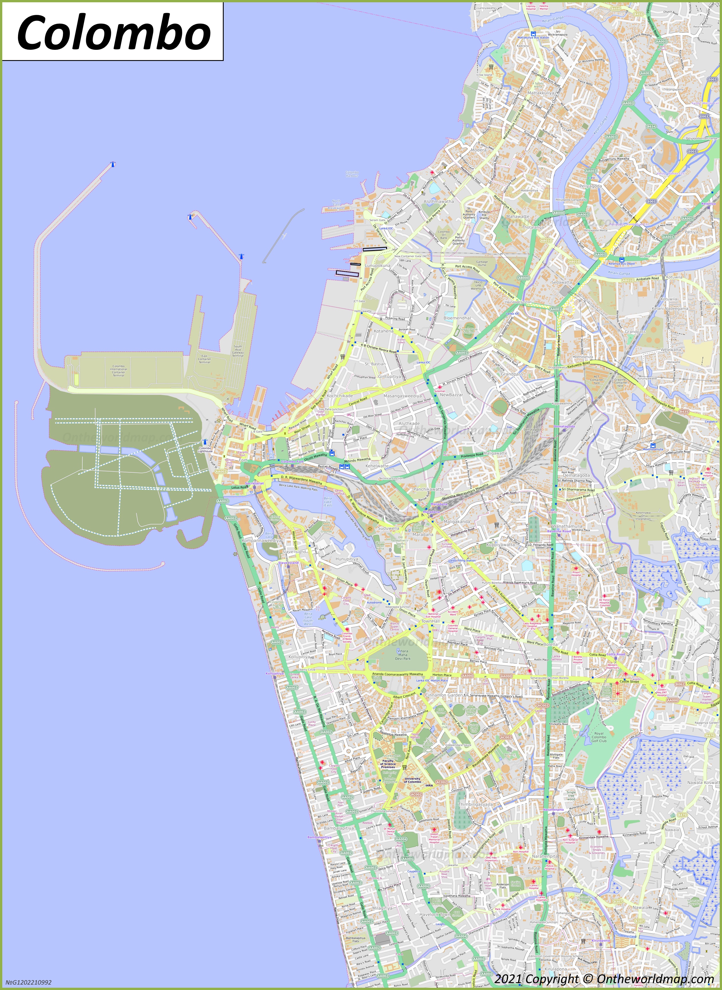
Description:
This map shows neighborhoods, streets, roads, lakes, rivers, buildings, hospitals, viewpoints, lighthouses, piers, railways, railway stations, and parks in Colombo.
Size: 2524x3460px / 3.15 Mb
Author: Ontheworldmap.com
Map based on the free editable OSM map openstreetmap.org.
You may download, print or use the above map for educational, personal and non-commercial purposes. Attribution is required. For any website, blog, scientific research or e-book, you must place a hyperlink (to this page) with an attribution next to the image used.
Colombo City Center Map

Description:
This map shows streets, trails, houses, buildings, cafes, bars, restaurants, hotels, monuments, museums, parking lots, shops, temples, points of interest, restrooms, and parks in Colombo City Center.
Size: 2482x1665px / 1.26 Mb
Author: Ontheworldmap.com
Map based on the free editable OSM map openstreetmap.org.
You may download, print or use the above map for educational, personal and non-commercial purposes. Attribution is required. For any website, blog, scientific research or e-book, you must place a hyperlink (to this page) with an attribution next to the image used.
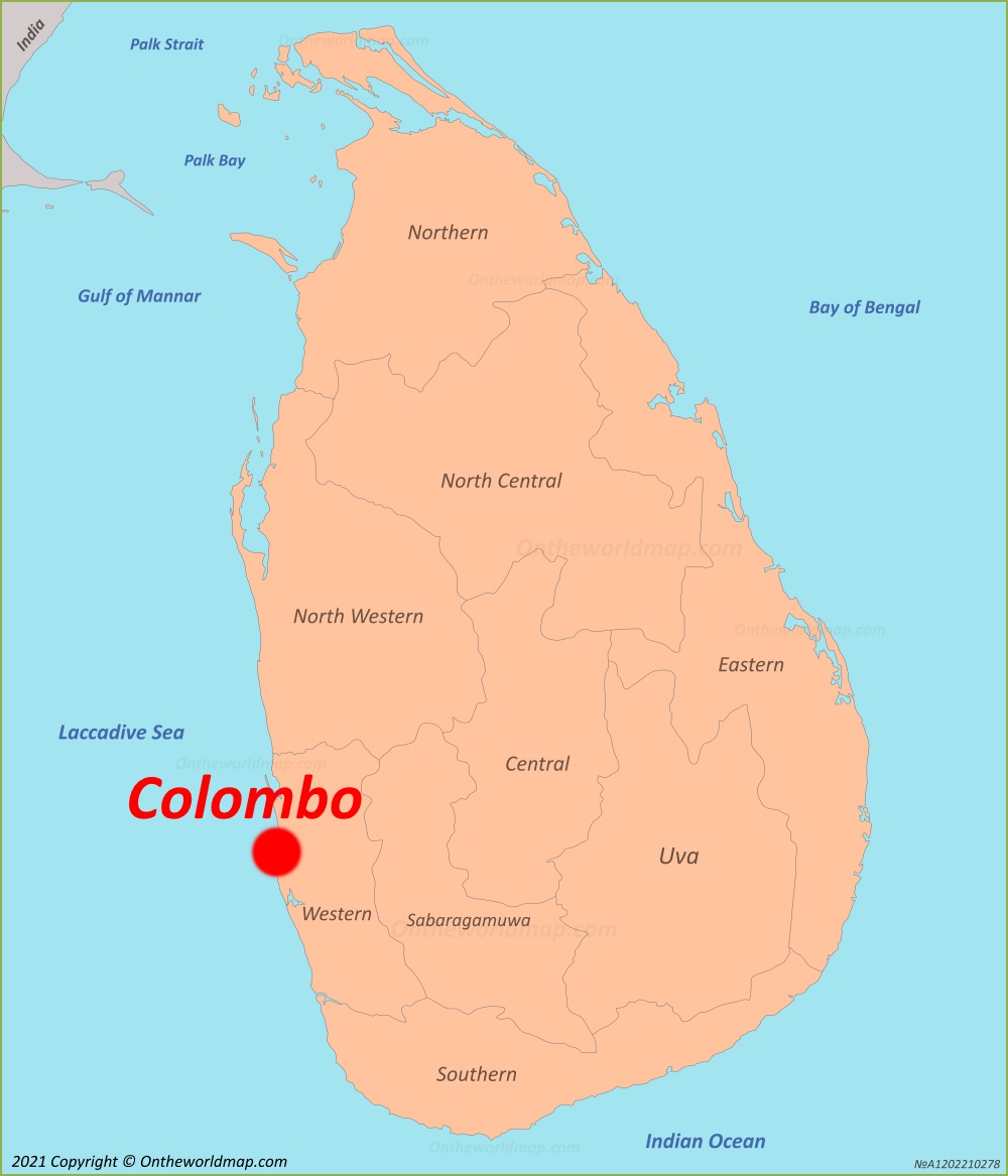
Online Map of Colombo
About Colombo
Colombo is the executive and judicial capital and the largest city of Sri Lanka. It lies on the island's west coast, next to Sri Jayawardenepura Kotte, which is the country's legislative capital. Colombo is Sri Lanka's main commercial, financial and cultural centre.
The Facts:| Province: | Western Province |
| District: | Colombo District |
| Population: | ~ 770,000 |
| Metropolitan population | 5,700,000 |
| Area: | 390 sq mi (1,000 sq km) |
| Coordinates: | 6°56′04″N 79°50′34″E |
| Ethnic groups (2025): |
|
| Postal code: | 0xxxx |
| Area code(s): | 011 |
| Official Website: | www.colombo.mc.gov.lk |
The origin of the name is uncertain. One theory traces it to the Sinhala name Kolamba. Another links it to the phrase Kola-amba-thota, meaning "harbour with leafy mango trees". During their rule, the Portuguese adopted the form "Colombo", possibly in honour of Christopher Columbus.
Thanks to its large natural harbour, Colombo was known to traders for more than 2,000 years. Merchants came from Arabia, Persia, China and the Roman world. In the 14th century, the traveller Ibn Battuta visited the port and called it Kalanpu. The Portuguese arrived in 1505 and built a fort in 1517. The Dutch captured the city in 1656. British forces took it in 1796, and in 1815 it became the capital of the British Crown Colony of Ceylon. It stayed the capital after Ceylon became independent in 1948. In the 1980s, parliament moved to Sri Jayawardenepura Kotte, but Colombo kept its commercial role.
The city is governed by the Colombo Municipal Council, which is led by a mayor.
The Port of Colombo is one of the busiest container ports in South Asia and a major transshipment hub. The city also hosts the Colombo Stock Exchange and the headquarters of many national and international companies. Port City Colombo is a large development being built on land reclaimed next to the central business district.
Colombo's population is diverse. Its main groups are the Sinhalese, Sri Lankan Tamils and Sri Lankan Moors, and there are smaller Burgher and Malay communities. Buddhism, Hinduism, Islam and Christianity are all practised in the city. Well-known landmarks include Galle Face Green, the Gangaramaya Temple, Viharamahadevi Park and the Colombo Lotus Tower, one of the tallest structures in South Asia.
Colombo has a tropical climate with high temperatures all year. Most of its rain falls during the two monsoon seasons.
Modern Colombo features a mix of colonial architecture and contemporary developments. Notable landmarks include the Galle Face Green, a sprawling urban park along the coastline, the historic Gangaramaya Temple, and the Independence Memorial Hall. The National Museum of Colombo, established in 1877, houses important cultural artifacts and historical collections.
Maps of Sri Lanka
Cities of Sri Lanka