
Belmopan Map

Description:
This map shows neighborhoods, streets, roads, parking lots, rivers, buildings, hospitals, shops, and parks in Belmopan.
Size: 2533x1720px / 1.3 Mb
Author: Ontheworldmap.com
Map based on the free editable OSM map openstreetmap.org.
You may download, print or use the above map for educational, personal and non-commercial purposes. Attribution is required. For any website, blog, scientific research or e-book, you must place a hyperlink (to this page) with an attribution next to the image used.
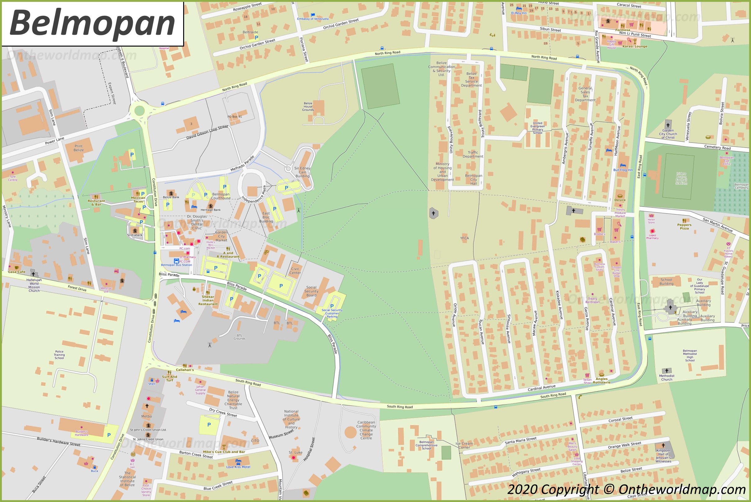
Description:
This map shows streets, trails, buildings, cafes, bars, restaurants, hotels, shops, churches, parking lots, points of interest, and parks in Downtown Belmopan.
Size: 2419x1617px / 879 Kb
Author: Ontheworldmap.com
Map based on the free editable OSM map openstreetmap.org.
You may download, print or use the above map for educational, personal and non-commercial purposes. Attribution is required. For any website, blog, scientific research or e-book, you must place a hyperlink (to this page) with an attribution next to the image used.

Online Map of Belmopan
About Belmopan
Belmopan is the capital city of Belize. It lies in the Cayo District, about 80 kilometres (50 miles) inland from Belize City, near the Belize River valley. At the 2026 estimate it had around 23,000 residents, which makes it one of the smallest national capitals in the Americas by population.
The Facts:| District: | Cayo |
| Population (2026 estimate): | 23,000 |
| Density: | 2,200/sq mi (850/sq km) |
| Area: | 12.66 sq mi (32.78 sq km) |
| Coordinates: | 17°15′08″N 88°45′50″W |
| Area code(s): | 501 +8 |
The decision to build a new capital followed Hurricane Hattie, which struck the coast in October 1961 and caused severe damage in Belize City, then the seat of government. Authorities chose a site further inland and at a higher elevation, safer from storm surges and flooding. Construction began in the mid-1960s, and government offices moved to the new capital in 1970.
The name Belmopan combines the names of two rivers, the Belize and the Mopan.
Belmopan was officially granted city status in 2000. It is home to the National Assembly of Belize, whose building was designed to resemble a Maya temple, along with many government ministries and most foreign embassies in the country. The main campus of the University of Belize is also in the city.
The city is near the junction of the George Price Highway and the Hummingbird Highway, which link it to Belize City, the western border region and the southern part of the country. Guanacaste National Park is nearby.
Main sights in Belmopan
- National Assembly Building
- George Price Centre for Peace and Development
- Belmopan Market Square
- Belize Archives and Records Service
- Guanacaste National Park
- St. Herman's Blue Hole National Park
- Nohoch Che'en Caves Branch Archaeological Reserve
- Actun Tunichil Muknal
- Five Blues Lake National Park
- The Belize Zoo
Maps of Belize
Cities of Belize