
Hampton Bays Map
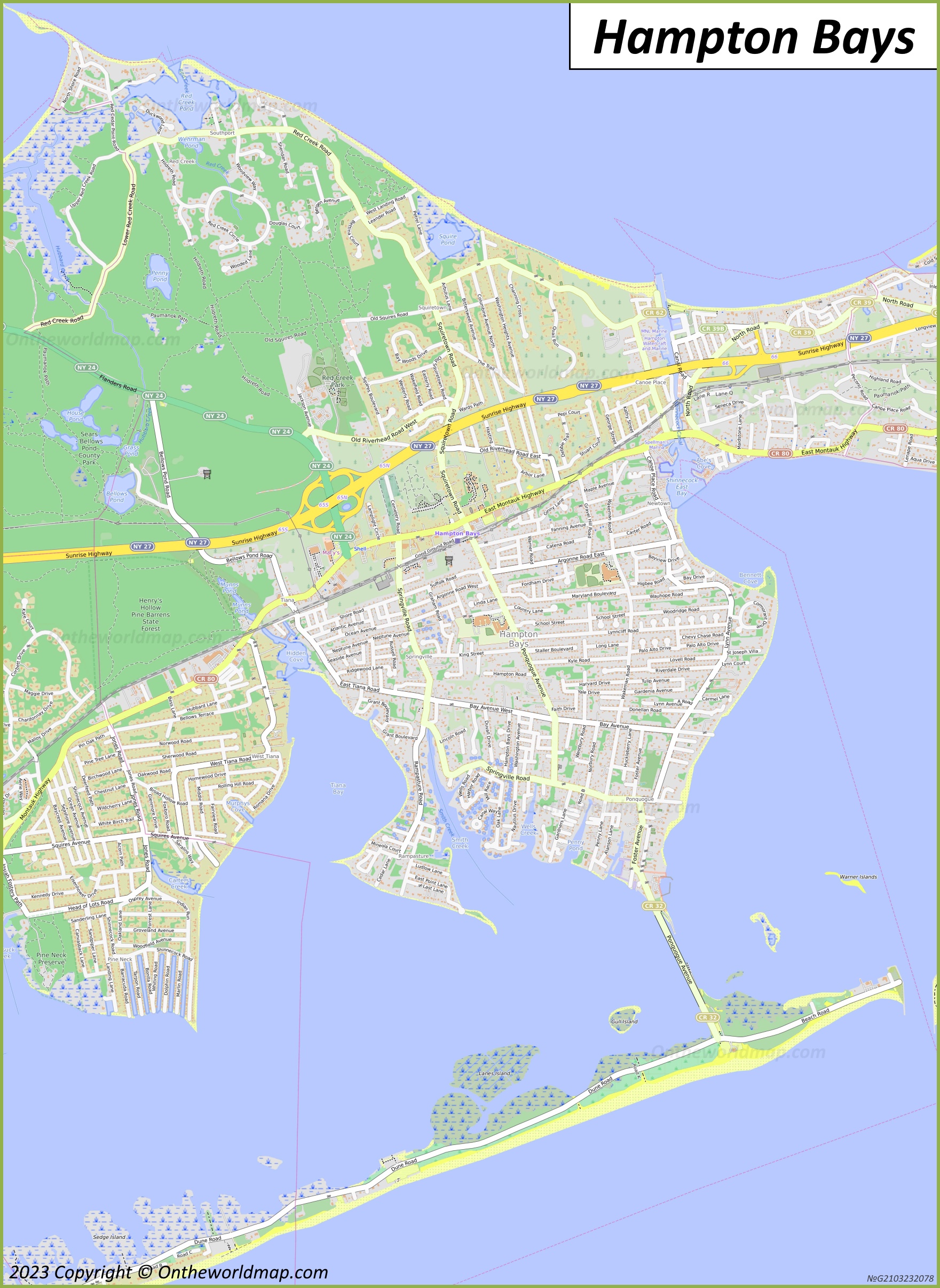
Description:
This map shows neighborhoods, streets, roads, trails, beaches, rivers, buildings, railways, railway stations, and parks in Hampton Bays.
Size: 1761x2413px / 1.33 Mb
Author: Ontheworldmap.com
Map based on the free editable OSM map openstreetmap.org.
You may download, print or use the above map for educational, personal and non-commercial purposes. Attribution is required. For any website, blog, scientific research or e-book, you must place a hyperlink (to this page) with an attribution next to the image used.
Downtown Hampton Bays Map
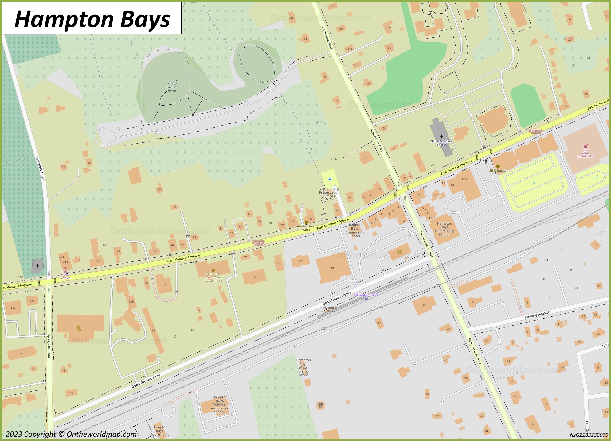
Description:
This map shows streets, trails, houses, buildings, cafes, restaurants, parking lots, shops, churches, points of interest, and parks in Downtown Hampton Bays.
Size: 1989x1437px / 765 Kb
Author: Ontheworldmap.com
Map based on the free editable OSM map openstreetmap.org.
You may download, print or use the above map for educational, personal and non-commercial purposes. Attribution is required. For any website, blog, scientific research or e-book, you must place a hyperlink (to this page) with an attribution next to the image used.
Hampton Bays Location On The Long Island Map
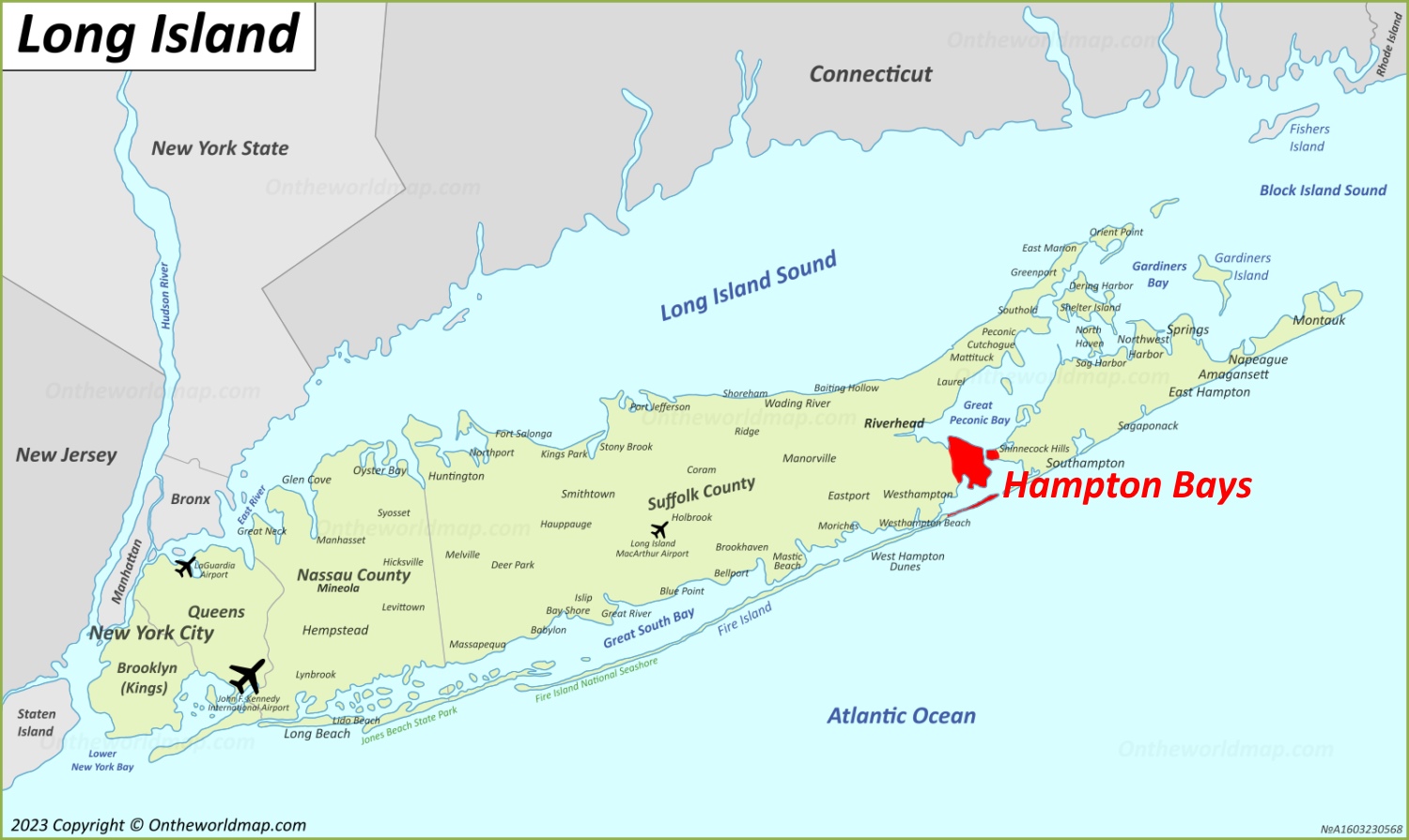
Description:
This map shows where Hampton Bays is located on Long Island.
Size: 1500x895px / 280 Kb
Author: Ontheworldmap.com
You may download, print or use the above map for educational, personal and non-commercial purposes. Attribution is required. For any website, blog, scientific research or e-book, you must place a hyperlink (to this page) with an attribution next to the image used.
Hampton Bays Location On The New York State Map
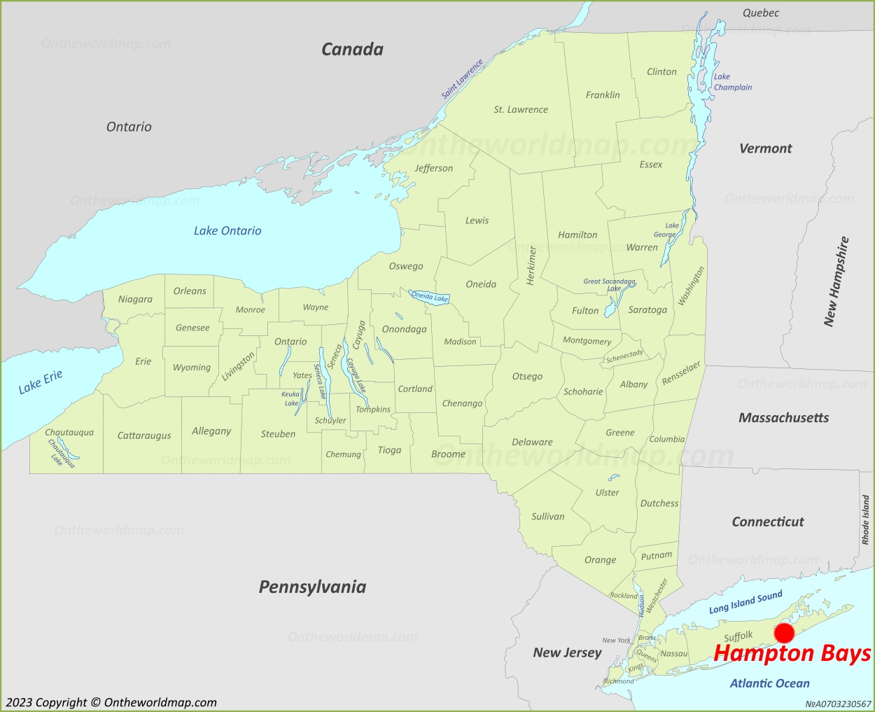
Description:
This map shows where Hampton Bays is located in New York State.
Size: 1250x1017px / 234 Kb
Author: Ontheworldmap.com
You may download, print or use the above map for educational, personal and non-commercial purposes. Attribution is required. For any website, blog, scientific research or e-book, you must place a hyperlink (to this page) with an attribution next to the image used.
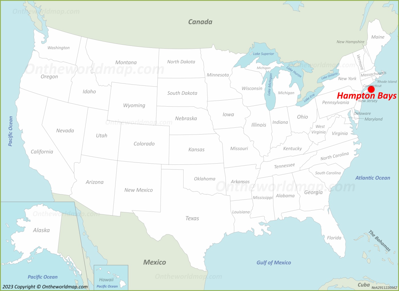
Online Map of Hampton Bays


About Hampton Bays
Hampton Bays is a hamlet and census-designated place (CDP) located in the Town of Southampton, Suffolk County, New York, United States. It lies on the South Shore of Long Island, between Shinnecock Bay to the east and the Shinnecock Canal, which separates it from the rest of the Hamptons.
The Facts:| State: | New York |
| County: | Suffolk |
| Island: | Long Island |
| Town: | Southampton |
| Population: | ~ 15,500 |
| Density: | 1,177.3/sq mi (454.54/sq km) |
| Area: | 20.51 sq mi (53.12 sq km) |
| Coordinates: | 40°52′26″N 72°31′16″W |
| Racial/ethnic groups (2020): |
|
| ZIP Codes: | 11946 |
| Area code(s): | 631, 934 |
| FIPS code: | 36-31896 |
| GNIS feature ID: | 0952135 |
As of the 2020 United States Census, the population of Hampton Bays was 15,228, making it one of the most populous hamlets within the Town of Southampton.
The area was originally known as Good Ground until 1922, when it was renamed Hampton Bays by local residents and business owners who sought to associate the community with the broader Hamptons region in order to attract tourism and development. Prior to European settlement, the land was inhabited by the Shinnecock people, whose reservation is located nearby on a peninsula east of the canal.
Hampton Bays is served by the Montauk Branch of the Long Island Rail Road and by New York State Route 27 (Sunrise Highway) and Montauk Highway (County Route 80). The Shinnecock Canal, completed in 1892, connects Shinnecock Bay with Great Peconic Bay and remains an important waterway for both commercial fishing and recreational boating.
The local economy is based largely on tourism, commercial fishing, and seasonal residential activity. Notable geographic features include Ponquogue Beach on the Atlantic Ocean, Tiana Beach, Meschutt Beach on Great Peconic Bay, and the Ponquogue Bridge, which spans Shinnecock Bay and connects the hamlet to Dune Road.
Hampton Bays is served by the Hampton Bays Union Free School District, which operates an elementary school, a middle school, and Hampton Bays High School.
Main sights in Hampton Bays
- Ponquogue Beach
- Meschutt Beach
- Tiana Beach
- Shinnecock Bay
- Good Ground Park
- Red Creek Park
- Hampton Bays Historical Society and Museum
- Shinnecock Canal
- Shinnecock Inlet
- Pine Neck
U.S. Maps
Cities of USA
States of USA
States of USA