
Hainan Map
Description:
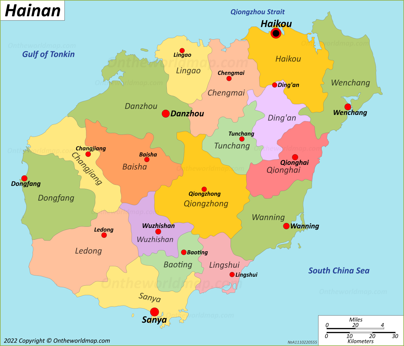
This map shows counties, county seats, major cities and towns on Hainan.
Size: 1400x1198px / 464 Kb
Author: Ontheworldmap.com
You may download, print or use the above map for educational, personal and non-commercial purposes. Attribution is required. For any website, blog, scientific research or e-book, you must place a hyperlink (to this page) with an attribution next to the image used.
Online Map of Hainan
About Hainan
Hainan is the southernmost province of the People's Republic of China. It consists of Hainan Island and a number of smaller islands in the South China Sea. The provincial capital and largest city is Haikou, on the island's northern coast.
The Facts:| Capital: | Haikou |
| Cities and Towns: | Haikou, Sanya, Danzhou, Wenchang, Wanning, Qionghai, Dongfang, Wuzhishan, Dongfang, Ding'an, Tunchang, Chengmai, Lingao, Baisha, Changjiang, Ledong, Lingshui, Baoting, Qiongzhong. |
| Area: | 13,587 sq mi (35,191 sq km) |
| Population (2020): | 10,081,232 |
| Density: | 741.96/sq mi (286.47/sq km) |
| Coordinates: | 19°12′N 109°42′E |
| Racial/ethnic groups (2020):[1] |
|
| Official Website: | hainan.gov.cn |
Hainan Island covers about 33,920 square kilometres (13,100 sq mi). It is the largest island administered by the People's Republic of China. The Qiongzhou Strait separates it from the Leizhou Peninsula of Guangdong Province to the north. The island has a tropical monsoon climate. The central part is mountainous and includes Wuzhi Mountain, which rises to about 1,840 metres (6,040 ft). The coastal areas are mostly lowlands and plains. The province also governs the city of Sansha, set up in 2012, which administers the Paracel Islands and other island groups in the South China Sea. Several of these territories are disputed with neighbouring countries.
Chinese control of the island dates back to 110 BC, when the Han dynasty set up the commanderies of Zhuya and Dan'er. For most of its later history, Hainan was administered as part of Guangdong. Japan occupied the island from 1939 to 1945. The People's Liberation Army took it in 1950. In 1988 Hainan became a separate province and was designated a special economic zone.
The province has a population of about 10 million. Most residents are Han Chinese. The largest ethnic minority is the Li people, who are indigenous to the island. Miao and Zhuang communities also live there.
Hainan's economy relies mainly on tourism, agriculture and services. The city of Sanya on the southern coast is a major beach resort. Important agricultural products include natural rubber, coconuts and tropical fruits. The Wenchang Space Launch Site, located in the northeast of the island, has hosted launches since 2016. In 2020 the central government published a master plan to develop Hainan into a free trade port.
Maps of China
Cities of China
Islands of China
Regions of China