
Washington, D.C. Capitol Hill Map
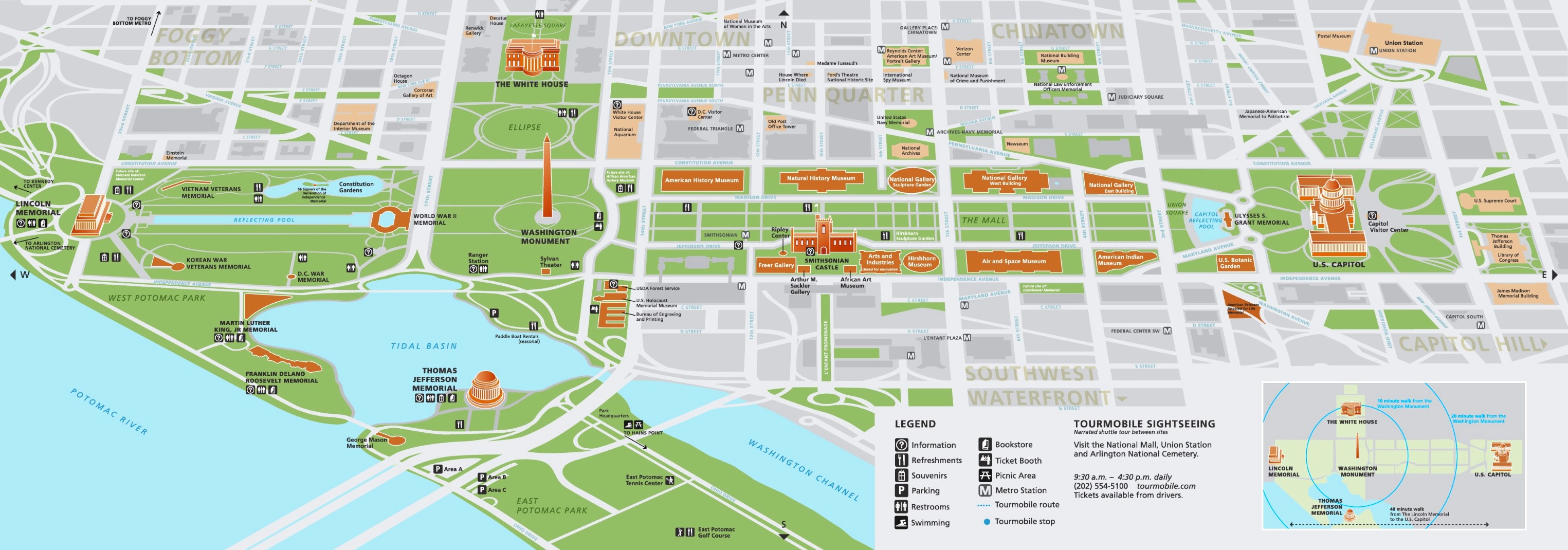
Description:
This map shows streets, roads, parking lots, metro stations, tourist information centers, restrooms, restaurants, picnic areas, souvenir shops, points of interest, tourist attractions, and sightseeings in Washington, D.C. Capitol Hill.
About Washington, D.C. Capitol Hill
Capitol Hill is the historic neighborhood immediately east of the Capitol, and it contains the largest historic residential district in the city. Its core is a grid of 19th-century rowhouses, with commercial corridors along Pennsylvania Avenue SE and Barracks Row on 8th Street SE.
Besides the Capitol, the area holds the Supreme Court, the Library of Congress, the Folger Shakespeare Library, the 1873 Eastern Market, and the Marine Barracks at 8th and I Streets, the oldest active post of the U.S. Marine Corps. Lincoln Park, at the eastern edge, contains the 1876 Emancipation Memorial.
You may download, print or use the above map for educational, personal and non-commercial purposes. Attribution is required. For any website, blog, scientific research or e-book, you must place a hyperlink (to this page) with an attribution next to the image used.
U.S. Maps
Cities of USA
States of USA
States of USA