
Upper West Side Map
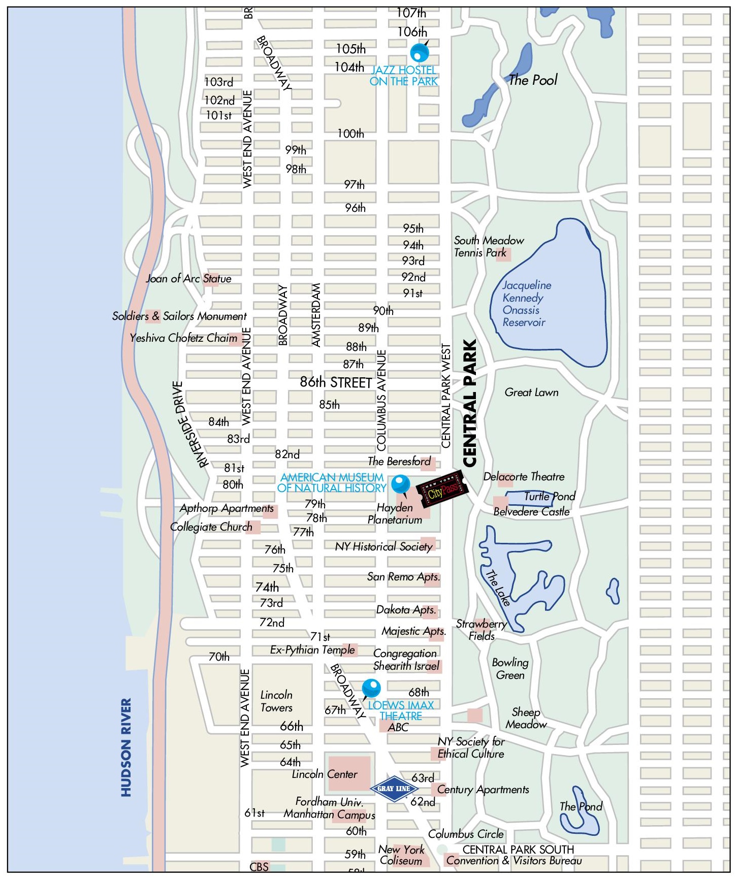
Description:
This map shows streets, roads, parks, points of interest, tourist attractions, and sightseeings in Upper West Side.
About Upper West Side
The Upper West Side is a neighborhood in Manhattan, New York City, bounded by Central Park to the east, the Hudson River to the west, West 59th Street to the south and West 110th Street to the north. It is primarily residential, and its main commercial corridors are Broadway, Amsterdam Avenue and Columbus Avenue.
Large-scale development began in the late 19th century, after the Ninth Avenue elevated railway opened in 1879 and the first subway line opened in 1904. The Dakota, completed in 1884, was one of the area's first luxury apartment buildings. John Lennon was killed outside it in 1980. Other notable residential buildings include the Ansonia, the San Remo and the Beresford.
The neighborhood contains the Lincoln Center for the Performing Arts, built in the 1960s. Its resident organizations include the Metropolitan Opera, the New York Philharmonic and the Juilliard School. The American Museum of Natural History, founded in 1869, occupies a large site facing Central Park and includes the Rose Center for Earth and Space, which opened in 2000. Riverside Park, designed by Frederick Law Olmsted, runs along the Hudson River.
You may download, print or use the above map for educational, personal and non-commercial purposes. Attribution is required. For any website, blog, scientific research or e-book, you must place a hyperlink (to this page) with an attribution next to the image used.
U.S. Maps
Cities of USA
States of USA
States of USA