
Upper East Side Map
Description:
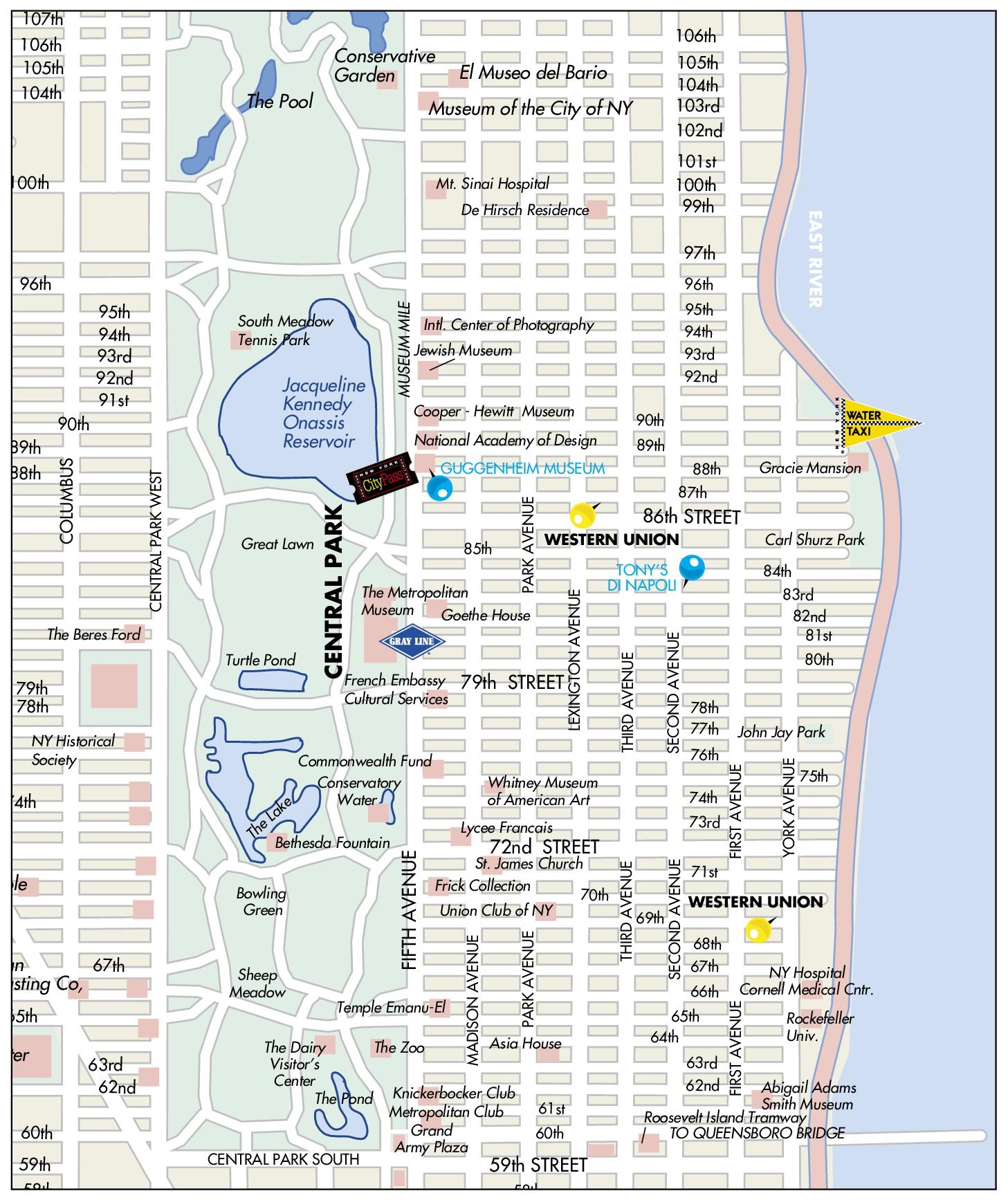
This map shows streets, parks, points of interest, tourist attractions, and sightseeings in Upper East Side.
About Upper East Side
The Upper East Side is a neighborhood in Manhattan, New York City, between Central Park and the East River, from East 59th Street to East 96th Street. It is one of the wealthiest neighborhoods in the United States. It includes the smaller neighborhoods of Lenox Hill, Carnegie Hill and Yorkville.
The section of Fifth Avenue facing Central Park is known as Museum Mile because of the many cultural institutions located along it. These include the Metropolitan Museum of Art, the Solomon R. Guggenheim Museum (designed by Frank Lloyd Wright and opened in 1959), the Neue Galerie, the Cooper Hewitt, Smithsonian Design Museum and the Jewish Museum. The Frick Collection is housed in the former mansion of industrialist Henry Clay Frick on Fifth Avenue at 70th Street.
Yorkville, in the eastern part of the neighborhood, historically had large German, Hungarian and Czech communities. Gracie Mansion, built in 1799 in Carl Schurz Park, has been the official residence of the Mayor of New York City since 1942. In 2017, the first phase of the Second Avenue Subway opened with new stations at 72nd, 86th and 96th Streets.
Several educational and medical institutions are located in the area, including Hunter College, Rockefeller University, Weill Cornell Medicine and Memorial Sloan Kettering Cancer Center. Madison Avenue between 57th and 79th Streets is known for its luxury boutiques.
You may download, print or use the above map for educational, personal and non-commercial purposes. Attribution is required. For any website, blog, scientific research or e-book, you must place a hyperlink (to this page) with an attribution next to the image used.
U.S. Maps
Cities of USA
States of USA
States of USA