
Midtown Manhattan Map
Description:
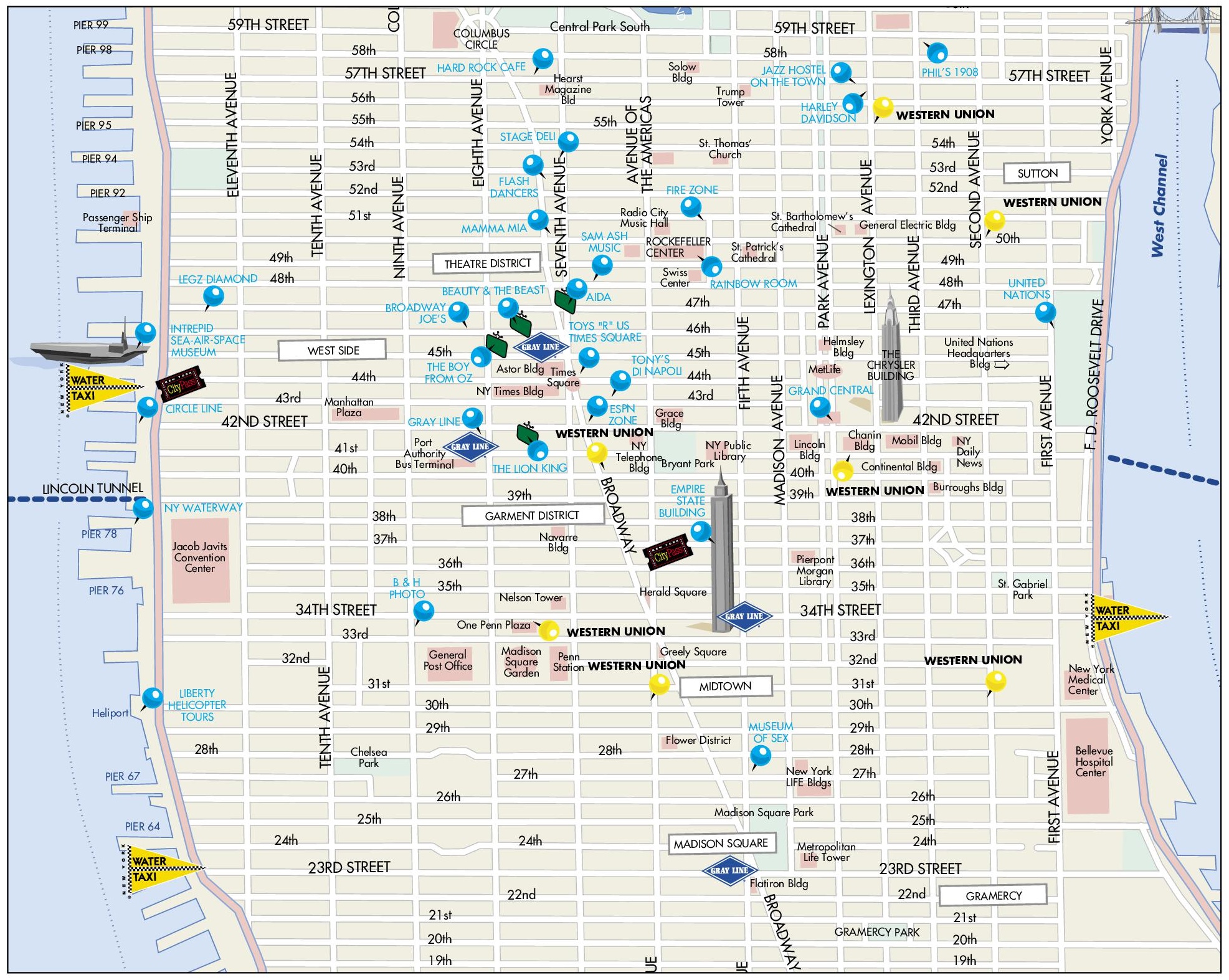
This map shows streets, piers, points of interest, tourist attractions, and sightseeings in Midtown Manhattan.
About Midtown Manhattan
Midtown Manhattan is the central portion of the New York City borough of Manhattan. It is generally considered to run from about 34th Street to 59th Street between the East River and the Hudson River, although broader definitions begin at 14th Street. It is the largest central business district in the United States and one of the largest commercial districts in the world.
Midtown has many of the city's best-known skyscrapers, including the Empire State Building (1931), the Chrysler Building (1930), Rockefeller Center and One Vanderbilt. Since the early 21st century, a group of supertall residential towers has been built along and near West 57th Street, an area informally known as "Billionaires' Row".
The district contains two of the city's main rail terminals, Grand Central Terminal and Pennsylvania Station, as well as the Port Authority Bus Terminal. Other landmarks include the United Nations Headquarters, St. Patrick's Cathedral, the Museum of Modern Art, Madison Square Garden, Bryant Park and the Stephen A. Schwarzman Building of the New York Public Library.
Neighborhoods within Midtown include Hell's Kitchen, the Theater District, the Garment District, Hudson Yards, Koreatown, Murray Hill, Turtle Bay and Kips Bay. Hudson Yards, built over a rail yard on the far West Side, opened its first major phase in 2019. It is one of the largest private real estate developments in the history of the United States.
You may download, print or use the above map for educational, personal and non-commercial purposes. Attribution is required. For any website, blog, scientific research or e-book, you must place a hyperlink (to this page) with an attribution next to the image used.
U.S. Maps
Cities of USA
States of USA
States of USA