
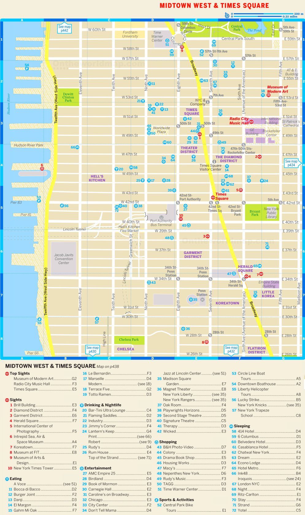
Map of Midtown West and Times Square
Description:
This map shows parks, bars, restaurants, hotels, shops, points of interest and sightseeings in Midtown West and Times Square (Manhattan, New York City).
About Midtown West and Times Square
Midtown West is the part of Midtown Manhattan west of Fifth Avenue, extending to the Hudson River. It includes the Theater District, Hell's Kitchen (also called Clinton), the Garment District and Hudson Yards. Times Square, at the junction of Broadway and Seventh Avenue, is at its center.
The Theater District around Times Square contains most of the 41 professional venues classified as Broadway theatres, each with at least 500 seats. Other cultural venues in Midtown West include Carnegie Hall (1891), Radio City Music Hall (1932) and the Intrepid Museum, which is housed aboard the aircraft carrier USS Intrepid at Pier 86.
The western part of the area has major transportation and convention facilities. The Port Authority Bus Terminal on Eighth Avenue is the busiest bus terminal in the world by passenger volume, and the Jacob K. Javits Convention Center lies along the Hudson River. Hudson Yards was developed over the West Side Yard of the Long Island Rail Road. It includes several skyscrapers, the Edge observation deck and the Shed arts center.
You may download, print or use the above map for educational, personal and non-commercial purposes. Attribution is required. For any website, blog, scientific research or e-book, you must place a hyperlink (to this page) with an attribution next to the image used.