
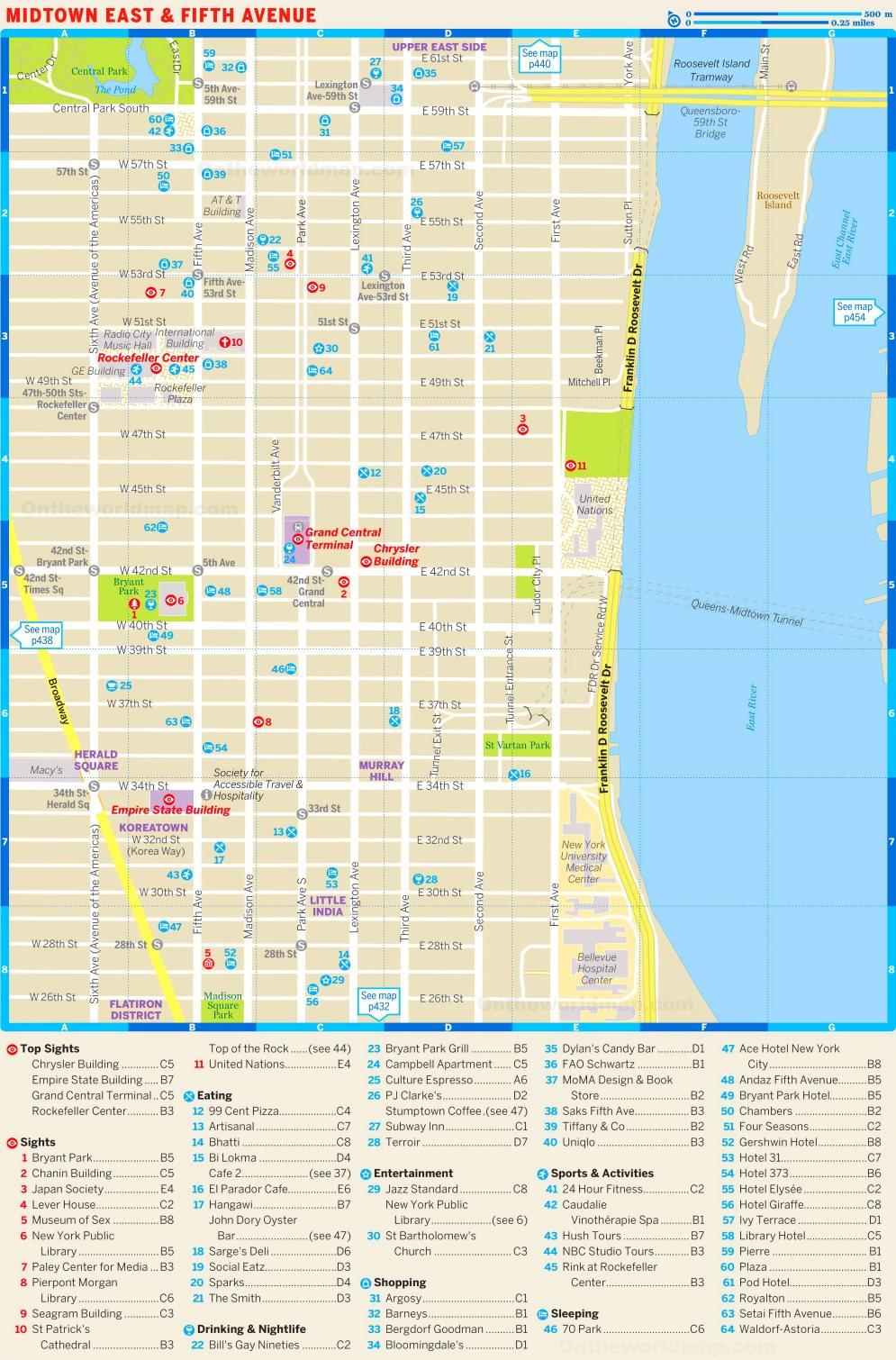
Map of Midtown East and Fifth Avenue
Description:
This map shows streets, hotels, bars, restaurants, shops and sightseeings in Midtown East and Fifth Avenue. (Manhattan, New York City)
About Midtown East and Fifth Avenue
Midtown East is the part of Midtown Manhattan east of Fifth Avenue. It includes the neighborhoods of Turtle Bay, Murray Hill, Sutton Place and Tudor City. It is one of the city's largest office districts, and its commercial buildings are concentrated along Park, Madison, Lexington and Third Avenues. Landmarks include Grand Central Terminal, the Chrysler Building and the Headquarters of the United Nations, which stands on the East River between 42nd and 48th Streets.
Park Avenue is lined with notable modernist office towers, among them Lever House (1952) and the Seagram Building (1958), designed by Ludwig Mies van der Rohe. In 2017, the city approved the East Midtown rezoning, which allowed taller buildings near Grand Central. One Vanderbilt, completed in 2020, was built under this framework and rises 1,401 feet (427 m).
Fifth Avenue is a major thoroughfare that serves as the dividing line between the East Side and West Side of Manhattan. Its Midtown section, roughly between 49th and 60th Streets, is consistently ranked among the most expensive shopping streets in the world. Flagship stores there include Saks Fifth Avenue, Tiffany & Co. and the Apple Fifth Avenue store with its glass cube entrance. The avenue also passes St. Patrick's Cathedral, Rockefeller Center and Grand Army Plaza, the site of the Plaza Hotel.
You may download, print or use the above map for educational, personal and non-commercial purposes. Attribution is required. For any website, blog, scientific research or e-book, you must place a hyperlink (to this page) with an attribution next to the image used.