
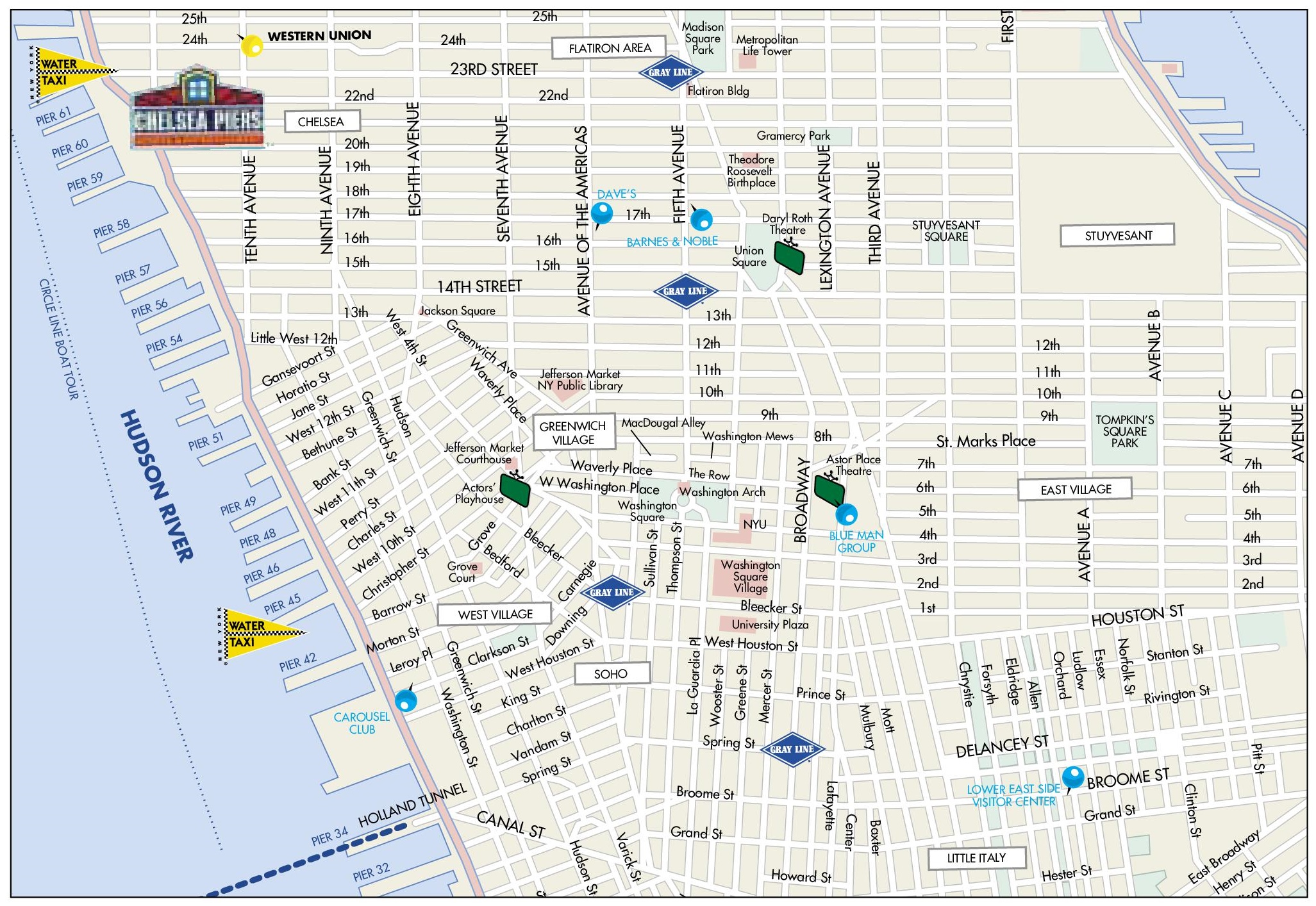
Map of Greenwich Village, Chelsea, Soho and Little Italy
Description:
This map shows streets, points of interest, and sightseeings in Greenwich Village, Chelsea, Soho and Little Italy.
About Greenwich Village, Chelsea, Soho and Little Italy
Greenwich Village, Chelsea, SoHo and Little Italy are neighborhoods in Lower and western Midtown Manhattan. They are known for their historic architecture, art scenes and cultural history. Greenwich Village developed as a separate village north of colonial New York, so many of its streets do not follow the Manhattan grid. In the 20th century it became a center of bohemian culture, the Beat Generation and the 1960s folk music revival.
SoHo, short for "South of Houston Street", is known for its cast-iron buildings, which are protected within the SoHo–Cast Iron Historic District, designated in 1973. In the 1960s and 1970s, artists converted the area's former industrial lofts into studios and living spaces. It has since become a high-end shopping district. Chelsea, to the north, has one of the largest concentrations of contemporary art galleries in the world, as well as the High Line and Chelsea Market.
Little Italy, centered on Mulberry Street, was once a large Italian immigrant enclave. It has shrunk considerably because of the expansion of neighboring Chinatown and the development of Nolita. The neighborhood still hosts the annual Feast of San Gennaro, held since 1926.
You may download, print or use the above map for educational, personal and non-commercial purposes. Attribution is required. For any website, blog, scientific research or e-book, you must place a hyperlink (to this page) with an attribution next to the image used.
U.S. Maps
Cities of USA
States of USA
States of USA