
Map of Chelsea
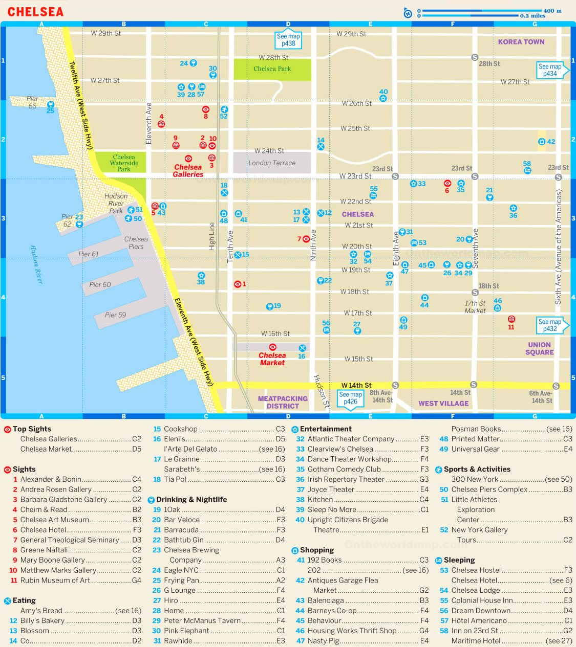
Description:
This map shows bars, restaurants, hotels, nightclubs, shops, and tourist attractions in Chelsea (Manhattan, New York City).
About Chelsea
Chelsea is a neighborhood on the West Side of Manhattan, generally bounded by 14th Street to the south, 30th Street to the north, the Hudson River to the west and Sixth Avenue to the east. It takes its name from the estate of Major Thomas Clarke, acquired in 1750, which he named after the Royal Hospital Chelsea in London.
Clarke's grandson, Clement Clarke Moore, developed the estate in the 1820s and 1830s. He donated land for the General Theological Seminary, and Moore is also credited with writing the poem "A Visit from St. Nicholas". Many 19th-century rowhouses from this period survive within the Chelsea Historic District. The Hotel Chelsea, completed in 1884, is known for its many artist and writer residents, including Dylan Thomas, Arthur C. Clarke and Patti Smith.
Since the 1990s, Chelsea has become a major center of the contemporary art market, with hundreds of galleries concentrated between Tenth and Eleventh Avenues. Chelsea Market occupies the former National Biscuit Company factory, where the Oreo cookie was developed in 1912. The High Line runs along the western part of the neighborhood, and the Chelsea Piers sports and entertainment complex opened on the Hudson River in 1995.
You may download, print or use the above map for educational, personal and non-commercial purposes. Attribution is required. For any website, blog, scientific research or e-book, you must place a hyperlink (to this page) with an attribution next to the image used.