
Map of Brooklyn Heights, Downtown Brooklyn and Dumbo
Description:
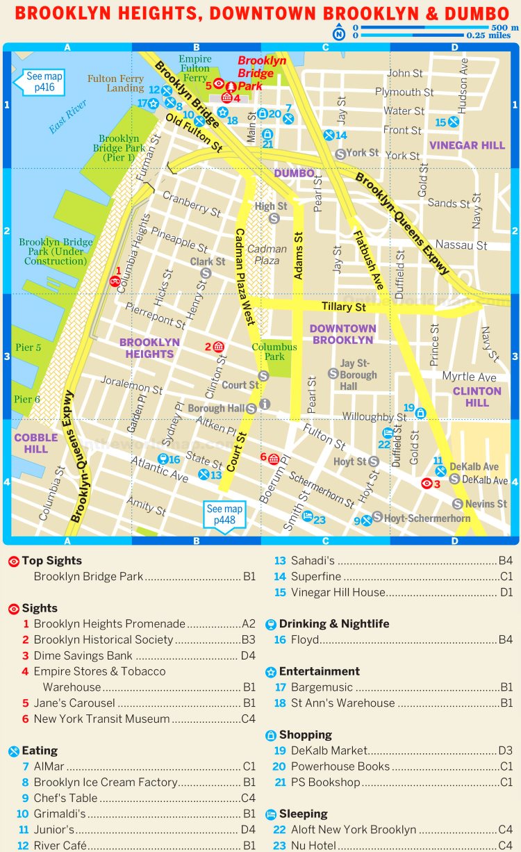
This map shows streets, restaurants, shops, and sightseeings in Brooklyn Heights, Downtown Brooklyn and Dumbo (Brooklyn, New York City).
About Brooklyn Heights, Downtown Brooklyn and Dumbo
Brooklyn Heights is a residential neighborhood in northwestern Brooklyn, facing Lower Manhattan across the East River. In 1965 it became the first historic district designated under the New York City Landmarks Law, adopted that same year. The neighborhood is known for its 19th-century rowhouses and for the Brooklyn Heights Promenade, a walkway built over the Brooklyn–Queens Expressway that offers views of the Manhattan skyline. Plymouth Church, where Henry Ward Beecher preached, was a stop on the Underground Railroad.
Downtown Brooklyn is the borough's civic and commercial center and the third-largest central business district in New York City. It contains Brooklyn Borough Hall (1848), state and federal courthouses and the MetroTech Center office complex. A 2004 rezoning led to the construction of many high-rise residential towers. The Barclays Center arena, opened in 2012, is located at the neighborhood's southeastern edge.
Dumbo, an acronym for "Down Under the Manhattan Bridge Overpass", lies along the waterfront between the Brooklyn Bridge (1883) and the Manhattan Bridge (1909). Residents coined the name in 1978. The area was formerly an industrial district of warehouses and factories. The Dumbo Historic District was designated in 2007, and the neighborhood is now known for its converted lofts, technology firms and galleries.
Brooklyn Bridge Park, an 85-acre (34 ha) park on the East River waterfront, runs along Brooklyn Heights and Dumbo on former shipping piers. It contains Jane's Carousel, a restored 1922 carousel housed in a glass pavilion designed by Jean Nouvel.
You may download, print or use the above map for educational, personal and non-commercial purposes. Attribution is required. For any website, blog, scientific research or e-book, you must place a hyperlink (to this page) with an attribution next to the image used.
U.S. Maps
Cities of USA
States of USA
States of USA