
Logan Map
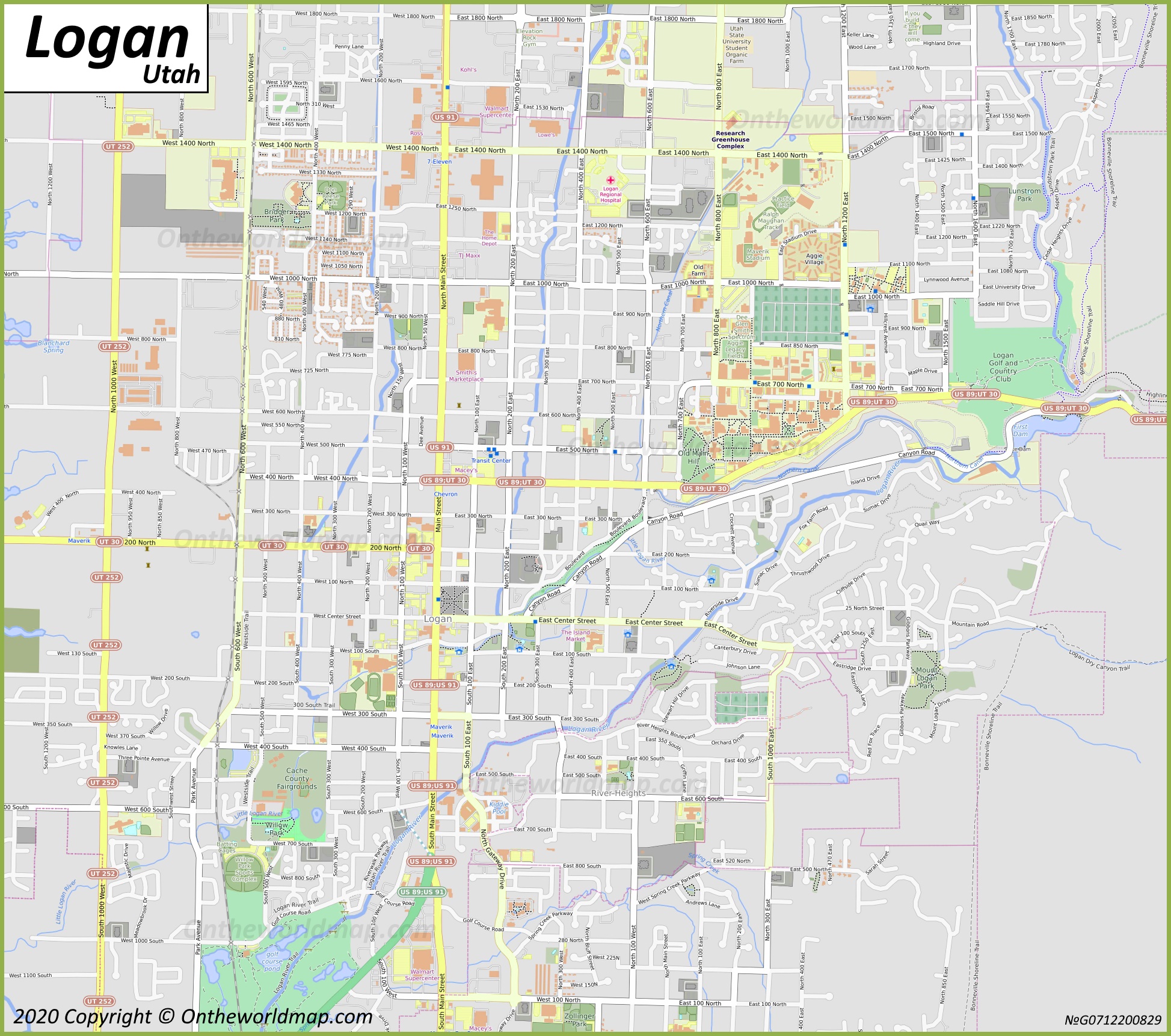
Description:
This map shows neighborhoods, streets, roads, trails, golf courses, rivers, buildings, railways, railway stations, and parks in Logan.
Size: 1947x1722px / 1.09 Mb
Author: Ontheworldmap.com
Map based on the free editable OSM map openstreetmap.org.
You may download, print or use the above map for educational, personal and non-commercial purposes. Attribution is required. For any website, blog, scientific research or e-book, you must place a hyperlink (to this page) with an attribution next to the image used.
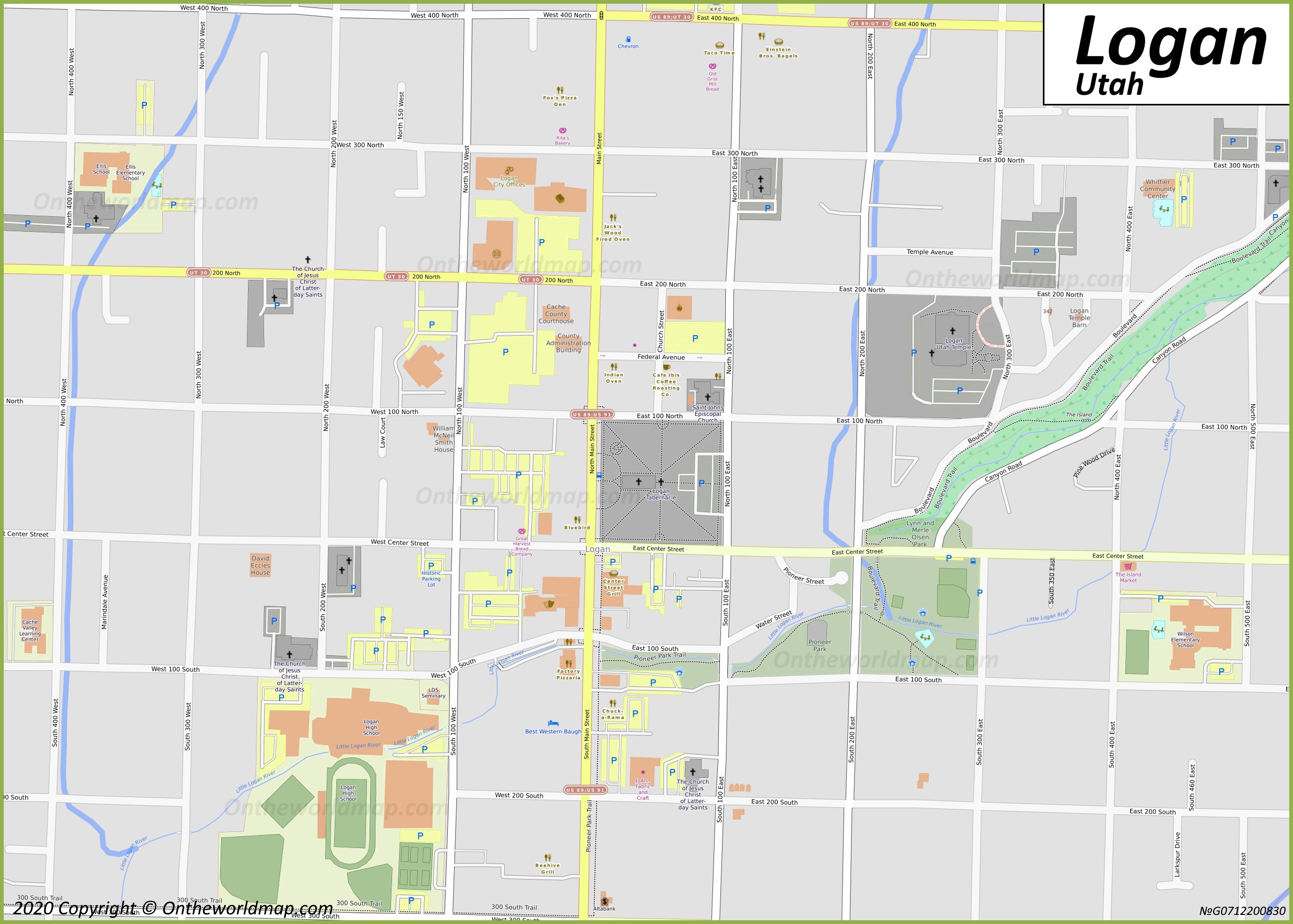
Description:
This map shows streets, trails, houses, buildings, playgrounds, cafes, bars, restaurants, hotels, parking lots, shops, churches, points of interest, and parks in Downtown Logan.
Size: 2414x1726px / 758 Kb
Author: Ontheworldmap.com
Map based on the free editable OSM map openstreetmap.org.
You may download, print or use the above map for educational, personal and non-commercial purposes. Attribution is required. For any website, blog, scientific research or e-book, you must place a hyperlink (to this page) with an attribution next to the image used.
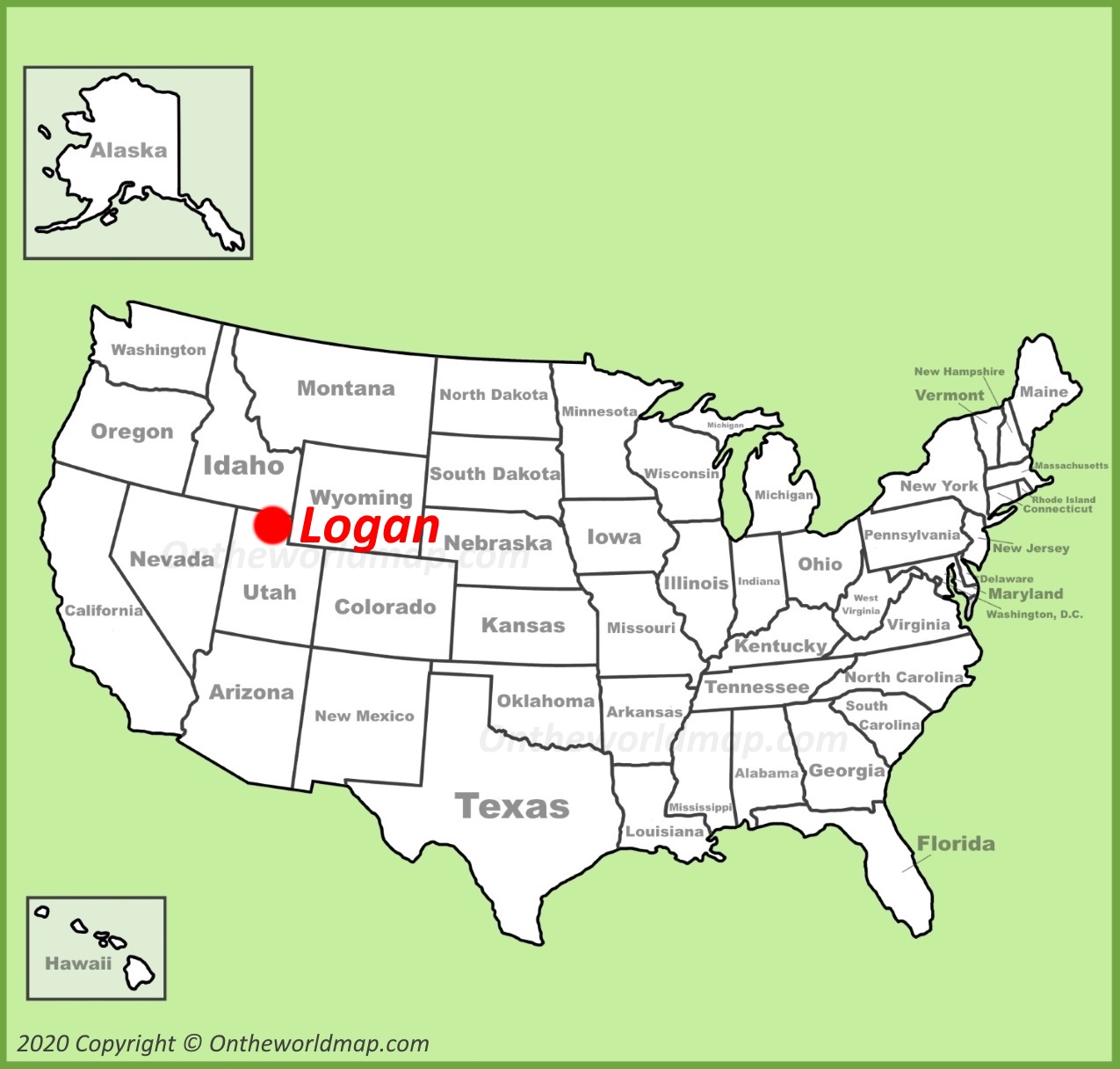
Online Map of Logan
About Logan
Logan is a city in Cache County, Utah, United States. It serves as the county seat and is the principal city of the Logan metropolitan area, which includes Cache County and Franklin County, Idaho. As of the 2025, the city had a population of 55,576.
The Facts:| State: | Utah |
| County: | Cache |
| Population (2025): | 55,576[1] |
| Density: | 2,958/sq mi (1,142/sq km) |
| Area: | 18.43 sq mi (47.74 sq km) |
| Coordinates: | 41°45′50″N 111°52′21″W |
| Racial/ethnic groups (2025):[1] |
|
| ZIP Codes: | 84321-84323, 84341 |
| Area code(s): | 435 |
| FIPS code: | 49-45860 |
| GNIS feature ID: | 2410856 |
| Official Website: | www.loganutah.gov |
Logan is located in the Cache Valley, a high mountain valley in the Bear River Mountains, approximately 82 miles (132 km) north of Salt Lake City. The city sits at an elevation of about 4,534 feet (1,382 m) above sea level. The Logan River flows through the city from Logan Canyon to the east.
The city was founded in 1859 by settlers of The Church of Jesus Christ of Latter-day Saints and was named after Ephraim Logan, an early fur trapper in the region.
Logan is home to Utah State University, a public land-grant research university established in 1888 as the Agricultural College of Utah. The university is a major economic and cultural force in the city. Logan is also the site of the Logan Utah Temple, completed in 1884, and the Logan Tabernacle, both notable examples of 19th-century Latter-day Saint architecture.
The local economy is supported by education, manufacturing, agriculture, and healthcare. Notable employers include Utah State University, Icon Health & Fitness, Schreiber Foods, and Intermountain Healthcare's Logan Regional Hospital. The city has a humid continental climate with cold, snowy winters and warm, dry summers, and is known for persistent winter temperature inversions that affect air quality in the valley.
Main sights in Logan
- Utah State University
- Logan Tabernacle
- Logan Utah Temple
- American West Heritage Center
- Willow Park Zoo
- Logan Canyon Scenic Byway
- First Dam Park
- Second Dam
- Bear Lake
- Wind Caves
- Tony Grove Lake
- Ellen Eccles Theatre
- Cache Museum - Daughters of Utah Pioneers
- Nora Eccles Harrison Museum of Art
References
1. ^ QuickFacts Logan. United States Census Bureau.U.S. Maps
Cities of USA
States of USA
States of USA