
Allentown Map
Description:
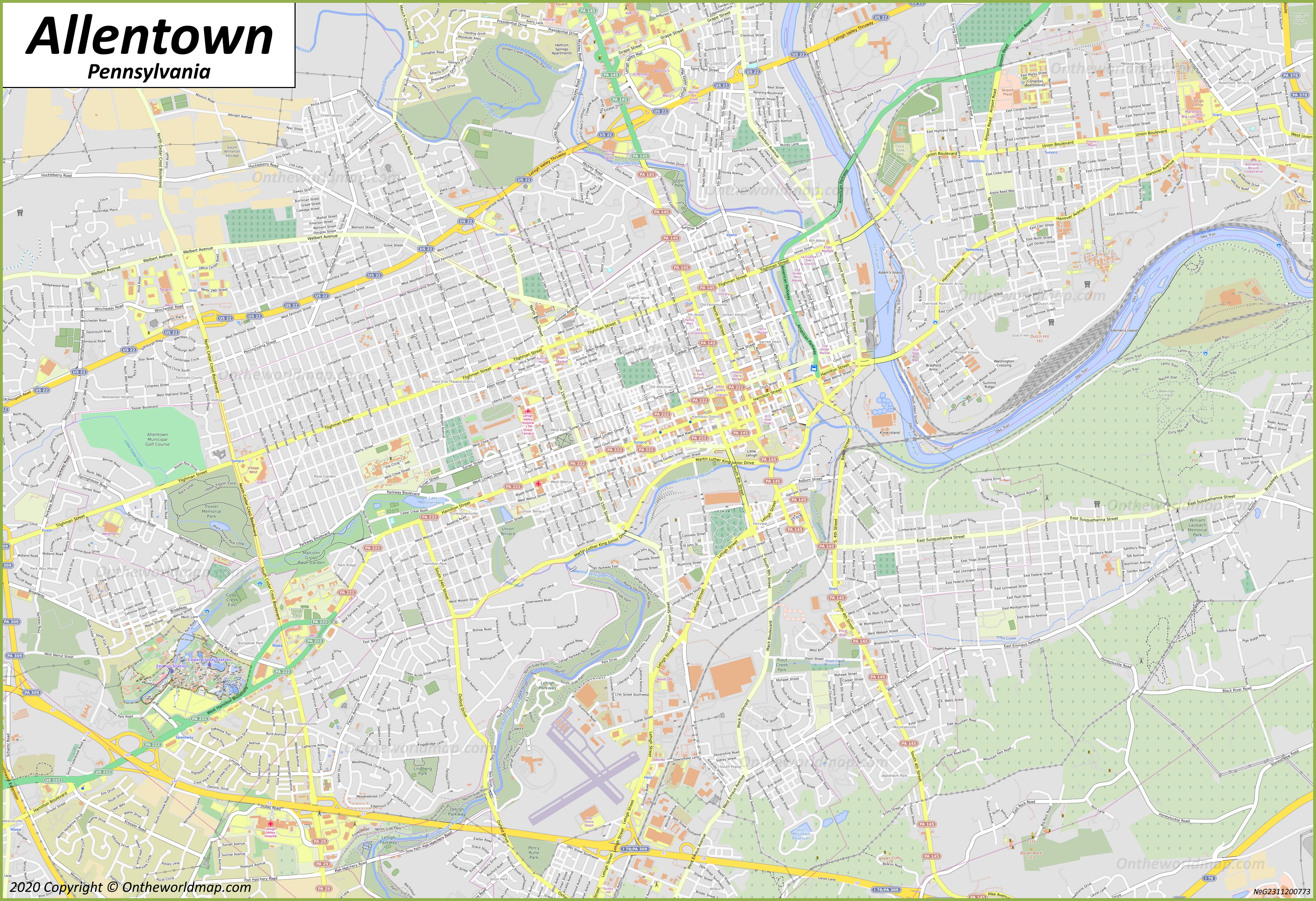
This map shows neighborhoods, streets, roads, lakes, rivers, buildings, airports, railways, railway stations, and parks in Allentown.
Size: 3722x2549px / 3.89 Mb
Author: Ontheworldmap.com
Map based on the free editable OSM map openstreetmap.org.
You may download, print or use the above map for educational, personal and non-commercial purposes. Attribution is required. For any website, blog, scientific research or e-book, you must place a hyperlink (to this page) with an attribution next to the image used.

Online Map of Allentown


About Allentown
Allentown is a city in and the county seat of Lehigh County, Pennsylvania, United States. It is the third-most populous city in the state, after Philadelphia and Pittsburgh, with a population of 126,044 as of the 2025.
The Facts:| State: | Pennsylvania |
| County: | Lehigh |
| Population (2025): | 126,044[1] |
| Metropolitan population: | 865,310 |
| Density: | 7,164.8/sq mi (2,766.35/sq km) |
| Area: | 18.01 sq mi (46.64 sq km) |
| Coordinates: | 40°36′06″N 75°28′38″W |
| Racial/ethnic groups (2025):[1] |
|
| ZIP Codes: | 18101, 18102, 18103, 18104, 18105, 18106, 18109, 18175, and 18195 |
| Area code(s): | 610, 484, 835 |
| FIPS code: | 42-02000 |
| GNIS feature ID: | 1213700, 1215372 |
| Official Website: | www.allentownpa.gov |
Located on the Lehigh River, Allentown is the largest city in the Lehigh Valley metropolitan region, which also includes the cities of Bethlehem and Easton. The city lies approximately 60 miles north of Philadelphia and about 90 miles west of New York City.
Allentown was founded in 1762 by William Allen, a wealthy Philadelphia merchant and former mayor of Philadelphia. It was originally named Northampton Town. The city was incorporated as a borough in 1811 and officially renamed Allentown in 1838. It received its city charter in 1867.
During the American Revolution, the Liberty Bell was hidden in the Zion Reformed Church in Allentown to prevent its capture by British forces.
In the 19th and early 20th centuries, Allentown developed as an industrial center, with manufacturing in iron, steel, textiles, and later electronics and trucks. The economy has since diversified toward healthcare, services, and transportation. Lehigh Valley International Airport serves the surrounding region.
Main sights in Allentown
- Dorney Park & Wildwater Kingdom
- Allentown Art Museum
- Da Vinci Science Center
- America On Wheels Museum
- PPL Center
- Coca-Cola Park
- Liberty Bell Museum
- Lehigh Valley Heritage Museum
- Museum of Indian Culture
- Miller Symphony Hall
- Civic Theatre of Allentown
- Cedar Beach Park
- Lehigh Parkway
- Malcolm W. Gross Memorial Rose Garden
- Lil-Le-Hi Trout Nursery
- Trexler Nature Preserve
- Jordan Creek Greenway Trail
- West Park
- Bicentennial Park
- Zion Reformed United Church of Christ
References
1. ^ QuickFacts Allentown. United States Census Bureau.U.S. Maps
Cities of USA
States of USA
States of USA